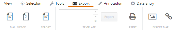
The Export toolbar consists of a set of tools to generate outputs of data or maps from the Map View or from a selection.
Mail Merge
The Mail Merge tool in IntraMaps allows users to download information from the organisations corporate database, based on multiple objects that have been selected (i.e. property parcels) and merge this information into a template that has been written to return the information in a specified format. The Mail Merge tool will generate a document per map object selected.
Discuss with a system administrator about setting up Mail Merges.

Export to Word
|
Export data to a Word document.
- Ensure at least one map object is selected
- Click on the Export to Word icon
- If a mail merge template has been configured, users will see one or many predefined templates available in the Template panel
- Click on a template to select it
- Click Export
- Users will be prompted to Save or Open the resulting Word document
|

Export to CSV
|
Export data to a CSV file.
- Ensure at least one map object is selected
- Click on the Export to CSV icon
- If a mail merge template has been configured, users will see one or many predefined templates available in the Template panel
- Click on a template to select it
- Click Export
- Users will then be prompted to Save or Open the resulting CSV file
|
Report
The Report tool works similarly to the Mail Merge tool, however Report provides more specific information for one selected map object instead of the entire selection.
Discuss with a system administrator about setting up Reports.

Report
|
Export data to a Report document.
- Ensure at least one map object is selected
- Click on the Report icon
- If a report template has been configured, users will see one or many predefined templates available in the Template panel
- Click on a template to select it
- Click Export
- Users will then be prompted to Save or Open the resulting document
|
Producing Maps
There are three ways to produce maps in IntraMaps.

Print
|
Users can export PDF or Word maps depending on what templates are configured. If there is a specific template required, speak with a system administrator.
- Click on the Print tool to activate the Print display
- Select a template from the drop-down list
- Choose the file type: PDF or Word. Note: When Render is set to Word, only Raster format can be set. PDF can export to Vector or Raster formats
- Add a title to the map
- Users can change the scale of the map by using the increase and decrease scale buttons. This will change the size of the purple box that signifies the print area. Users can move the preview area by using the cursor to pan the map
- Click Print
- Save the resulting map when prompted
|

Export Map Image
|
Use the Export Map Image tool to export an image which can then use to insert into documents or emails.
- Click on the Export Map Image icon
- Users can change the orientation, the size (manual, A4 or A3) and scale. Note: Width and Height can only be edited if Size is set to Manual
- Change the scale using the increase and decrease scale buttons
- Select a format: Image (PNG) or Vector (PDF)
- Click Export Map
- The map will open in a new browser window. Right click on the image and Save, Email, Copy or Print
|

Share Map
|
Use the Share Map tool to share a current view, or selection, with other users. Be aware that the people to be shared with must have access to IntraMaps.
- Click on the Export icon
- Check the desired items to be included: Layers (if changes to layers have been made), Annotations (if included) and Selections (if active)
- Click ctrl-c to copy the link to the clipboard. A new link will be created automatically with each change that is made
- Share the link with other IntraMaps users either in an email, message or other form
|