Application
IntraMaps is a dynamic application and contains a wide range of its own set of tools. The IntraMaps application is displayed within a custom web browser which has the menu items and standard toolbars removed.
The IntraMaps screen consists of six main areas: Main Toolbar, Map Window, Information Panel, Search Panel, Sidebar and Title Bar.
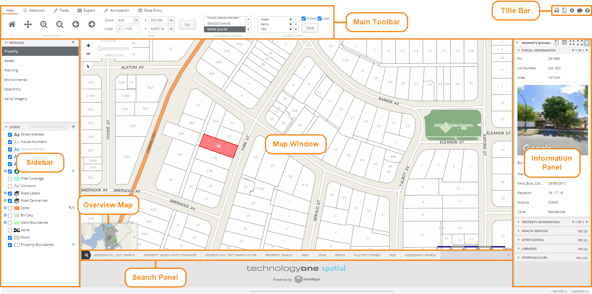
The Main Toolbar contains all the necessary tools to make selections, display information, control the view and navigate around the map. Users can carry out Mail Merge exports, add/edit/delete/save Annotations as well as Data Entry (if configured).
The Map Window displays the configured spatial data. It consists of one or more layers (groups of similar spatial data are often referred to as layers) and will often show both raster data (aerial imagery) and vector data (points, lines & polygons). To navigate within the map window use the navigation tools located above the map.
The Information Panel is dynamic and only displays when a Selection is made. The data displayed is highly flexible and may be sourced from a variety of different databases which are linked to the map layers in the map window.
Use the Search Panel to search for and select objects in the map window.
The Sidebar consists of two default panels: Modules & Layers. Modules contain search forms and map layers specifically chosen to produce a themed map and the Layers panel displays a list of all layers available in that module. There are other panels that reside in the Sidebar (Basemaps, Charts and Selection Filter) but these are only available if configured by a system administrator.
The Title Bar contains a number of functions, the default ones of which are generally: Print, Legend, Settings, Tooltip and Help.
The Overview Map is interactive and shows users a zoomed out view of where they are currently visualising the map.